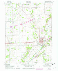
1960 Map of Knightstown
USGS Topo · Published 1982About this map
Knightstown and the surrounding farmland of Henry and Rush Counties are defined by the path of the historic National Road and the Big Blue River. This 1960s landscape, later updated in the early 1980s, reveals a network of small agricultural settlements like Charlottesville, Raysville, and Grant City linked by the Indiana Eastern Railroad and Transportation Co. The presence of institutions such as the Childrens Home and Morton Sch near the river indicates the area's role as a regional center for community services. Local genealogy is well-represented through numerous named burial grounds, including Glencove Cem and Carthage Cem, while the rural character is punctuated by quiet landmarks like the St Rose of Lima Ch and the remote Microwave Tower.
Find a feature on this map
47 named features on this map. Tap any name to fly to it.
Don’t see what you’re looking for? This feature index may not catch every label — zoom into the map to look around manually.
Map Details
Editions of this 1960 Knightstown Map
Other maps of this area

1949 · New Castle West
USGS Topo · 1:24,000

1950 · Dunreith
USGS Topo · 1:24,000

1953 · Pendleton
USGS Topo · 1:24,000

1953 · Cincinnati
USGS Topo · 1:250,000

1956 · Cleveland
USGS Topo · 1:24,000

1956 · Morristown
USGS Topo · 1:24,000

1957 · Cincinnati
USGS Topo · 1:250,000

1959 · Mays
USGS Topo · 1:24,000

1960 · New Castle West
USGS Topo · 1:24,000
1960 · Carthage
USGS Topo · 1:24,000