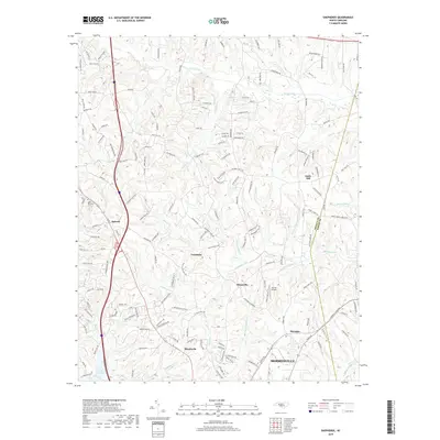
2019 Map of Shepherds
USGS Topo · Published 2019About this map
Troutman and the northern outskirts of Mooresville anchor this 2019 survey of the Iredell County landscape, where suburban expansion meets long-standing agricultural roots. The terrain is defined by a dense network of watercourses, including Third Creek and Withrow Creek, which drain the rolling piedmont toward the southern reaches of Lake Norman. Historically significant sites like the Saint Michaels Cem near Ostwalt provide touchpoints for genealogists, while smaller named communities such as Shepherds, Shinnville, and Mazeppa illustrate the localized settlement patterns of the region. The map also records the rural infrastructure of the era, from the landing strip at Atwell Airport to the intricate web of family-named roads like Brown Farms Dr and Isenhour Farm Ln, reflecting the transition of former farmsteads into a more residential character.
Find a feature on this map
172 named features on this map. Tap any name to fly to it.
Don’t see what you’re looking for? This feature index may not catch every label — zoom into the map to look around manually.
Map Details
Editions of this 2019 Shepherds Map
This is the sole edition of this map. No revisions or reprints were ever made.
Other maps of this area

1893 · Statesville
USGS Topo · 1:125,000

1953 · Charlotte
USGS Topo · 1:250,000

1954 · Charlotte
USGS Topo · 1:250,000

1960 · Charlotte
USGS Topo · 1:250,000

1962 · Charlotte
USGS Topo · 1:250,000

1969 · Cool Springs
USGS Topo · 1:24,000

1969 · Shepherds
USGS Topo · 1:24,000

1969 · Troutman
USGS Topo · 1:24,000
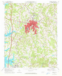
1969 · Mooresville
USGS Topo · 1:24,000

1969 · Statesville West
USGS Topo · 1:24,000