
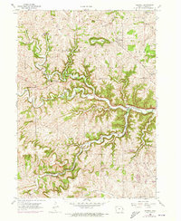
1956 Map of Sherrill
USGS Topo · Published 1958About this map
The Little Maquoketa River carves a deep path through the rolling hills of Dubuque County, where the 1950s landscape is defined by its rural school system and the engineering of the Chicago Great Western railroad. Prominent landmarks like Sherrill Mound overlook the village of Sherrill, while the surrounding countryside is dotted with neighborhood centers such as East Rickardsville, Five Points, and Budd. The settlement pattern reveals a transition in rural education, shown through numerous named schoolhouses including Cedar Ridge Sch and the Mangold Sch (Abandoned). The topography is further marked by deep ravines like Steer Hollow and Mangold Hollow, while the river is crossed by local infrastructure such as Redford Bridge. This survey captures the county's townships—Jefferson, Peru, Center, and Dubuque—just as the rural community was shifting toward larger centers like Asbury.
Find a feature on this map
32 named features on this map. Tap any name to fly to it.
Don’t see what you’re looking for? This feature index may not catch every label — zoom into the map to look around manually.
Map Details
Editions of this 1956 Sherrill Map
2 editions found
Other maps of this area

1900 · Lancaster
USGS Topo · 1:125,000

1901 · Peosta
USGS Topo · 1:125,000

1904 · Lancaster
USGS Topo · 1:125,000

1908 · Lancaster
USGS Topo · 1:125,000

1935 · East Dubuque
USGS Topo · 1:62,500

1940 · East Dubuque
USGS Topo · 1:62,500

1955 · Cassville
USGS Topo · 1:24,000

1955 · Dubuque South
USGS Topo · 1:24,000

1955 · Balltown
USGS Topo · 1:24,000

1956 · Dubuque North
USGS Topo · 1:24,000