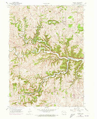
1956 Map of Sherrill
USGS Topo · Published 1973About this map
Sherrill Mound rises above the rolling terrain of Dubuque County, serving as a prominent landmark north of the village of Sherrill. This 1956 survey, with 1972 revisions, details a landscape defined by the convergence of several major waterways, including the North Fork Maquoketa River and the Middle Fork Maquoketa River. The topography is deeply dissected by drainage systems like Basswood Creek and Bloody Run, creating a pattern of ridges and valleys that historically dictated the placement of small rural communities and their schools.
Find a feature on this map
35 named features on this map. Tap any name to fly to it.
Don’t see what you’re looking for? This feature index may not catch every label — zoom into the map to look around manually.
Map Details
Editions of this 1956 Sherrill Map
2 editions found

Other maps of this area

1900 · Lancaster
USGS Topo · 1:125,000

1901 · Peosta
USGS Topo · 1:125,000

1904 · Lancaster
USGS Topo · 1:125,000

1908 · Lancaster
USGS Topo · 1:125,000

1935 · East Dubuque
USGS Topo · 1:62,500

1940 · East Dubuque
USGS Topo · 1:62,500

1955 · Cassville
USGS Topo · 1:24,000

1955 · Dubuque South
USGS Topo · 1:24,000

1955 · Balltown
USGS Topo · 1:24,000

1956 · Dubuque North
USGS Topo · 1:24,000