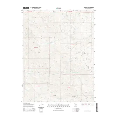
2015 Map of Sherwood Peak
USGS Topo · Published 2015About this map
Sherwood Valley occupies the eastern edge of this terrain, where the headwaters of several major coastal river systems converge. The map documents a complex drainage network including the S Fork Eel River and the Middle Fork Ten Mile River, illustrating the watershed divide between the Eel and Ten Mile basins. Distinctive clearings or meadows known locally as "openings," such as Case Opening and Ames Opening, are interspersed among the ridges. High points like Sherwood Peak and Strong Mtn dominate the landscape, connected by a series of prominent landforms including Bucha Ridge and Lake Ridge. The road network, featuring Sherwood Rd and Stage Coach Rd, follows the traditional paths through this portion of Mendocino County, providing access to the more remote Sherwood Ridge and Booth Gulch areas.
Find a feature on this map
36 named features on this map. Tap any name to fly to it.
Don’t see what you’re looking for? This feature index may not catch every label — zoom into the map to look around manually.
Map Details
Editions of this 2015 Sherwood Peak Map
This is the sole edition of this map. No revisions or reprints were ever made.
Other maps of this area

1920 · Glenblair
USGS Topo · 1:62,500

1921 · Branscomb
USGS Topo · 1:62,500

1922 · Willits
USGS Topo · 1:62,500

1942 · Willits
USGS Topo · 1:62,500

1943 · Glenblair
USGS Topo · 1:62,500

1944 · Willits
USGS Topo · 1:62,500

1951 · Branscomb
USGS Topo · 1:62,500

1951 · Laytonville
USGS Topo · 1:62,500

1957 · Ukiah
USGS Topo · 1:250,000

1960 · Ukiah
USGS Topo · 1:250,000