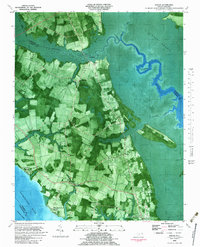
1982 Map of Shiloh
USGS Topo · Published 1983About this map
Indiantown and the surrounding coastal plains of Camden County are captured here in a 1980s orthophoto survey, revealing a landscape defined by the intersection of agrarian life and the vast wetlands of the Albemarle-Pamlico peninsula. The map documents numerous family-owned burial plots and Cem markers scattered across the fields near Smiths Corner and Riddle, providing an invaluable spatial record for genealogists. The influence of the water is omnipresent, from the Pasquotank River and the Intracostal Waterway on the western edge to the East North River and the edges of the Great Swamp in the east.
Find a feature on this map
32 named features on this map. Tap any name to fly to it.
Don’t see what you’re looking for? This feature index may not catch every label — zoom into the map to look around manually.
Map Details
Editions of this 1982 Shiloh Map
This is the sole edition of this map. No revisions or reprints were ever made.
Other maps of this area

1940 · Barco
USGS Topo · 1:62,500

1940 · Powells Point
USGS Topo · 1:62,500

1940 · Wade Point
USGS Topo · 1:62,500

1943 · Wade Point
USGS Topo · 1:62,500

1946 · Eastville
USGS Topo · 1:250,000

1946 · Currituck Sound
USGS Topo · 1:250,000

1948 · Wade Point
USGS Topo · 1:62,500

1948 · Elizabeth City
USGS Topo · 1:62,500

1953 · Norfolk
USGS Topo · 1:250,000

1961 · Eastville
USGS Topo · 1:250,000