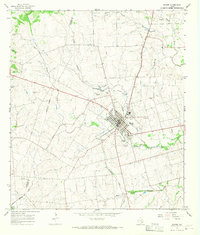
1965 Map of Shiner
USGS Topo · Published 1968About this map
The town of Shiner serves as the hub of this mid-1960s survey, showing a landscape defined by the intersection of the Southern Pacific railroad and a network of creeks including Boggy Creek and Rocky Creek. The civic life of the community is anchored by St Paul High Sch, Comanche Stadium, and the expansive Green-Dickson Park bordering Green-Dickson Lake. Genealogists will find several burial sites preserved here, including Shiner Cem, San Pedro Cem, and Bunjes Cem to the northeast.
Find a feature on this map
23 named features on this map. Tap any name to fly to it.
Don’t see what you’re looking for? This feature index may not catch every label — zoom into the map to look around manually.
Map Details
Editions of this 1965 Shiner Map
2 editions found
Other maps of this area

1901 · Flatonia
USGS Topo · 1:125,000

1953 · Seguin
USGS Topo · 1:250,000

1958 · Seguin
USGS Topo · 1:250,000

1959 · Hochheim
USGS Topo · 1:24,000

1959 · Hamon
USGS Topo · 1:24,000

1962 · Dilworth
USGS Topo · 1:24,000

1963 · Yoakum
USGS Topo · 1:24,000

1963 · Sweet Home
USGS Topo · 1:24,000

1965 · Wied
USGS Topo · 1:24,000

1965 · Komensky
USGS Topo · 1:24,000