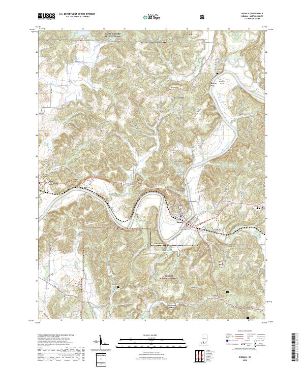
2022 Map of Shoals
USGS Topo · Published 2022About this map
Shoals serves as the focal point of this Indiana landscape, situated along the meandering path of the East Fork White River. The map details the seat of local government at the Martin County Court House and reveals the tight-knit settlement patterns of surrounding communities like Ironton, Lacy, and Dover Hill. To the north, the footprint of the Naval Support Activity Crane enters the frame, marking a significant federal presence in the region. The river's influence is evident through named landmarks such as Heathen Bend, Pinnacle Rock, and House Rock, which define the local topography. Genealogists will find value in the documentation of family-named sites and burial grounds, including McBrides Cem and Sholts Cem, while the southern reaches transition into the protected woodlands of the Hoosier National Forest.
Find a feature on this map
125 named features on this map. Tap any name to fly to it.
Don’t see what you’re looking for? This feature index may not catch every label — zoom into the map to look around manually.
Map Details
Editions of this 2022 Shoals Map
This is the sole edition of this map. No revisions or reprints were ever made.
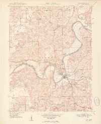
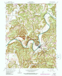
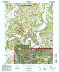
Historical Maps of Ironton Through Time
4 maps found