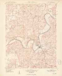
1950 Map of Shoals
USGS Topo · Published 1950About this map
The East Fork White River carves a dramatic, winding path through this mid-century Indiana landscape, defining the character of Shoals and its surrounding uplands. The terrain is marked by distinctive formations like Heathen Bend, McBrides Bluff, and Pinnacle Rock, which provide a sharp contrast to the lower floodplains. The Baltimore and Ohio railroad corridor serves as the primary industrial artery, passing through Ironton and near the steep Peek Cut. This 1950 edition captures a community defined by rural institutions, including Mt Union Ch, Hickory Ridge Sch, and the Beech Grove Sch, many located along the high ridges of the Martin County State Forest. The northern boundary is sharply delineated by the U S Naval Depot Boundary, marking a transition from public forest and agricultural land to federal reservation.
Find a feature on this map
50 named features on this map. Tap any name to fly to it.
Don’t see what you’re looking for? This feature index may not catch every label — zoom into the map to look around manually.
Map Details
Editions of this 1950 Shoals Map
2 editions found
Other maps of this area

1935 · Oolitic
USGS Topo · 1:48,000

1942 · Oolitic
USGS Topo · 1:62,500

1948 · Huron
USGS Topo · 1:24,000

1950 · Huron
USGS Topo · 1:24,000

1950 · Shoals
USGS Topo · 1:24,000

1950 · Odon
USGS Topo · 1:24,000

1951 · Hillham
USGS Topo · 1:24,000

1956 · Alfordsville
USGS Topo · 1:24,000

1956 · Loogootee
USGS Topo · 1:24,000

1956 · Rusk
USGS Topo · 1:24,000