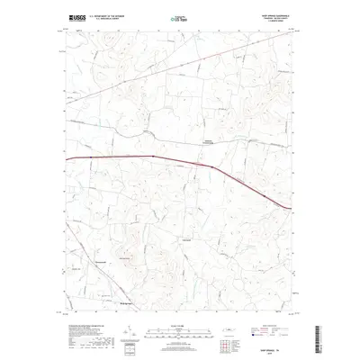
2019 Map of Shop Springs
USGS Topo · Published 2019About this map
Shop Springs and the surrounding Wilson County countryside are defined by a complex network of waterways and historic pikes that have long facilitated movement through this part of Tennessee. The topography is anchored by prominent elevations such as Jennings Knob and Hankins Hill, while the drainage of Jennings Fork and Spring Creek carves a path through the rolling landscape. The map captures established rural hubs like Tuckers Crossroads and Linwood, connected by enduring thoroughfares like the Trousdale Ferry Pike and Sparta Pike. Local family history is rooted in the presence of the Bethlehem Cem and Byran Cem, which sit alongside numerous named roads such as Swindell Hollow Rd and Saulsbury Rd. This layout illustrates a landscape where early settlement patterns, likely dictated by the creek valleys and the proximity to pikes, remain clearly visible in the modern road network and community placements.
Find a feature on this map
61 named features on this map. Tap any name to fly to it.
Don’t see what you’re looking for? This feature index may not catch every label — zoom into the map to look around manually.
Map Details
Editions of this 2019 Shop Springs Map
This is the sole edition of this map. No revisions or reprints were ever made.
Other maps of this area

1942 · Statesville
USGS Topo · 1:100,000

1942 · Gallatin
USGS Topo · 1:100,000

1942 · Lebanon
USGS Topo · 1:100,000

1951 · Lebanon
USGS Topo · 1:24,000

1955 · Hunters Point
USGS Topo · 1:24,000

1956 · Vine
USGS Topo · 1:24,000

1956 · Nashville
USGS Topo · 1:250,000

1958 · New Middleton
USGS Topo · 1:24,000

1958 · Bellwood
USGS Topo · 1:24,000

1958 · Watertown
USGS Topo · 1:24,000