2023 Map of Shreve
USGS Topo · Published 2023About this map
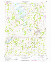
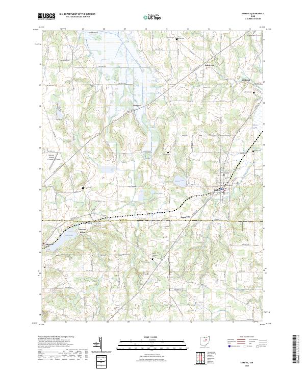
The village of Shreve serves as the central hub of this agricultural landscape along the border of Wayne and Holmes Counties. The topography is defined by significant wetlands and glacial lakes, including the expansive Funk Bottoms to the northwest and Killbuck Swamp in the east. These low-lying areas contrast with the clustered settlements of Big Prairie and Springville, which are connected by a dense network of township and county roads. Numerous burial sites, such as Maple Grove Cem and Ripley Township Cem, provide valuable points of reference for genealogists tracking early families in the region. To the west, Odell Lake and Lakeland Beach represent established water-focused landmarks, while the presence of the Mohican Airpark and Scheibe Field reflects the area's modern aviation infrastructure amidst traditional farmsteads and rural hamlets like Millbrook and Craigton.
Find a feature on this map
103 named features on this map. Tap any name to fly to it.
Don’t see what you’re looking for? This feature index may not catch every label — zoom into the map to look around manually.
Map Details
Editions of this 2023 Shreve Map
This is the sole edition of this map. No revisions or reprints were ever made.