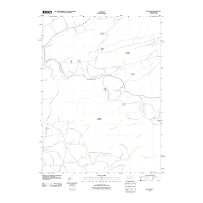
2010 Map of Shumans
USGS Topo · Published 2010About this map
Catawissa Creek winds through the heart of this landscape, cutting between the significant ridges of Nescopeck Mountain to the north and Catawissa Mountain in the south. This terrain is defined by a series of prominent peaks and hollows, including McCauley Mountain and the distinctively named Stranger Hollow. The network of rural roads such as Iron Bridge Rd and School House Ln suggests a long history of local travel through these valleys.
Find a feature on this map
58 named features on this map. Tap any name to fly to it.
Don’t see what you’re looking for? This feature index may not catch every label — zoom into the map to look around manually.
Map Details
Editions of this 2010 Shumans Map
This is the sole edition of this map. No revisions or reprints were ever made.
Other maps of this area

1889 · Catawissa
USGS Topo · 1:62,500

1892 · Catawissa
USGS Topo · 1:62,500

1892 · Mahanoy
USGS Topo · 1:62,500

1893 · Mahanoy
USGS Topo · 1:62,500

1894 · Catawissa
USGS Topo · 1:62,500

1894 · Shickshinny
USGS Topo · 1:62,500

1894 · Bloomsburg
USGS Topo · 1:62,500

1946 · Berwick
USGS Topo · 1:31,680

1947 · Bloomsburg
USGS Topo · 1:24,000

1947 · Ashland
USGS Topo · 1:24,000
Featured Places
- Locust Township, PA
- Main Township, PA
- Dogtown, Beaver Township
- Mifflin Cross Roads, Beaver Township
- Beaver Township, PA