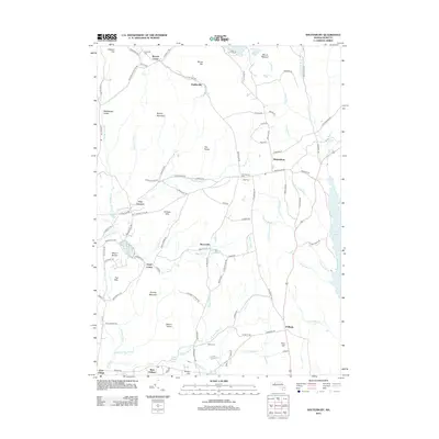
2012 Map of Shutesbury
USGS Topo · Published 2012About this map
Shutesbury and the surrounding Hampshire County highlands are defined by a network of small upland settlements and significant water management features in this 2012 survey. To the east, the edge of the Quabbin Reservoir dominates the landscape, while smaller impoundments like Atkins Reservoir, Baker Reservoir, and Hawley Reservoir are scattered throughout the hills. Small historic clusters such as Moores Corner, Dudleyville, and Baconville are linked by winding roads that navigate the complex topography of Brushy Mountain, Mount Orient, and the January Hills. Local genealogists will find several burial grounds mapped, including Plainview Cem and Valley Cem. The area’s natural character is further highlighted by distinctive geological landmarks like Rattlesnake Gutter and the medicinal history suggested by Orient Springs near West Pelham.
Find a feature on this map
117 named features on this map. Tap any name to fly to it.
Don’t see what you’re looking for? This feature index may not catch every label — zoom into the map to look around manually.
Map Details
Editions of this 2012 Shutesbury Map
This is the sole edition of this map. No revisions or reprints were ever made.
Other maps of this area

1885 · Northampton
USGS Topo · 1:62,500

1886 · Northampton
USGS Topo · 1:62,500

1887 · Warwick
USGS Topo · 1:62,500

1887 · Belchertown
USGS Topo · 1:62,500

1889 · Warwick
USGS Topo · 1:62,500

1890 · Belchertown
USGS Topo · 1:62,500

1890 · Greenfield
USGS Topo · 1:62,500

1891 · Northampton
USGS Topo · 1:62,500

1893 · Northampton
USGS Topo · 1:62,500

1893 · Belchertown
USGS Topo · 1:62,500