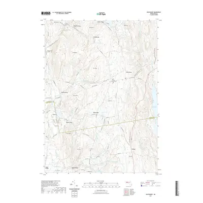
2021 Map of Shutesbury
USGS Topo · Published 2021About this map
Shutesbury and the surrounding rural uplands of Hampshire and Franklin Counties are defined by a complex network of reservoirs and stream valleys. The vast Quabbin Reservoir dominates the eastern edge, while smaller bodies of water like Lake Wyola Reservoir, Atkins Reservoir, and the Hill Reservoir are scattered throughout the wooded terrain. This 2021 survey shows a landscape where historic small settlements such as Locks Village, Baconville, and Moores Corner persist alongside modern trails like the New England National Scenic Trail. For local historians and genealogists, the map identifies specific burial sites including Plainview Cem, West Cem, Valley Cem, and the uniquely named Luther Henry Tomb Yard. The geography is characterized by prominent heights like Mt Mineral, January Hills, and Mt Orient, interspersed with distinctive natural features such as Rattlesnake Gutter and The Plains.
Find a feature on this map
107 named features on this map. Tap any name to fly to it.
Don’t see what you’re looking for? This feature index may not catch every label — zoom into the map to look around manually.
Map Details
Editions of this 2021 Shutesbury Map
This is the sole edition of this map. No revisions or reprints were ever made.
Other maps of this area

1885 · Northampton
USGS Topo · 1:62,500

1886 · Northampton
USGS Topo · 1:62,500

1887 · Warwick
USGS Topo · 1:62,500

1887 · Belchertown
USGS Topo · 1:62,500

1889 · Warwick
USGS Topo · 1:62,500

1890 · Belchertown
USGS Topo · 1:62,500

1890 · Greenfield
USGS Topo · 1:62,500

1891 · Northampton
USGS Topo · 1:62,500

1893 · Northampton
USGS Topo · 1:62,500

1893 · Belchertown
USGS Topo · 1:62,500