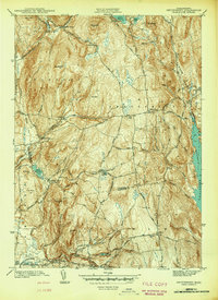
1942 Map of Shutesbury
USGS Topo · Published 1942About this map
Quabbin Reservoir dominates the eastern margin of this landscape, its shoreline captured here in the early 1940s just as the massive watershed project was completed. The map details the transition from the high ridges of Mt Mineral and Brushy Mtn down to the scattered rural settlements of Shutesbury and Pelham. This was an era of small-scale mountain farming and local industry, evidenced by the numerous reservoirs and brooks like Baker Reservoir and Amethyst Brook that once powered local mills.
Find a feature on this map
67 named features on this map. Tap any name to fly to it.
Don’t see what you’re looking for? This feature index may not catch every label — zoom into the map to look around manually.
Map Details
Editions of this 1942 Shutesbury Map
This is the sole edition of this map. No revisions or reprints were ever made.
Other maps of this area

1885 · Northampton
USGS Topo · 1:62,500

1886 · Northampton
USGS Topo · 1:62,500

1887 · Warwick
USGS Topo · 1:62,500

1887 · Belchertown
USGS Topo · 1:62,500

1889 · Warwick
USGS Topo · 1:62,500

1890 · Belchertown
USGS Topo · 1:62,500

1890 · Greenfield
USGS Topo · 1:62,500

1891 · Northampton
USGS Topo · 1:62,500

1893 · Northampton
USGS Topo · 1:62,500

1893 · Belchertown
USGS Topo · 1:62,500