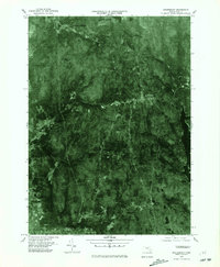
1975 Map of Shutesbury
USGS Topo · Published 1981About this map
Shutesbury and its surrounding villages are captured in this mid-1970s orthophotograph, providing a high-contrast visual record of the Franklin County landscape before late-century development. The eastern edge of the map is dominated by the waters of the Quabbin Reservoir, a massive artificial water source that fundamentally altered the geography of the region decades prior. The image reveals the heavy forest cover of Brushy Mountain and the scattered settlement patterns of small communities like Locks Village, Moores Corner, and Cooleyville.
Find a feature on this map
10 named features on this map. Tap any name to fly to it.
Don’t see what you’re looking for? This feature index may not catch every label — zoom into the map to look around manually.
Map Details
Editions of this 1975 Shutesbury Map
This is the sole edition of this map. No revisions or reprints were ever made.
Other maps of this area

1885 · Northampton
USGS Topo · 1:62,500

1886 · Northampton
USGS Topo · 1:62,500

1887 · Warwick
USGS Topo · 1:62,500

1887 · Belchertown
USGS Topo · 1:62,500

1889 · Warwick
USGS Topo · 1:62,500

1890 · Belchertown
USGS Topo · 1:62,500

1890 · Greenfield
USGS Topo · 1:62,500

1891 · Northampton
USGS Topo · 1:62,500

1893 · Northampton
USGS Topo · 1:62,500

1893 · Belchertown
USGS Topo · 1:62,500