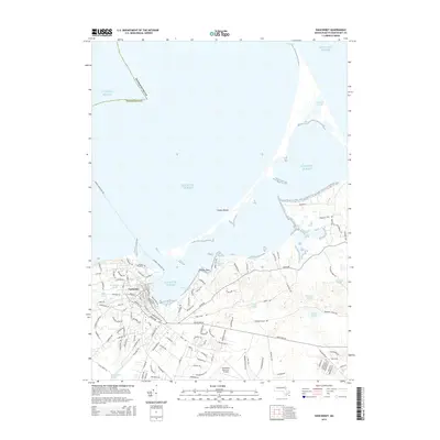
2015 Map of Siasconset
USGS Topo · Published 2015About this map
Nantucket occupies the southwestern corner of this survey, showing the density of the historic town core against the shifting coastal geography of the island in the mid-2010s. The landscape is defined by its numerous coastal kettle ponds and barrier beaches, such as the long reach of Coatue Beach and the narrow passage at The Galls. The interior is marked by a network of local roads and named water bodies including Gibbs Pond, Wigwam Ponds, and Almanac Pond, which indicate the complex drainage and historical land use patterns of the island's moorlands.
Find a feature on this map
124 named features on this map. Tap any name to fly to it.
Don’t see what you’re looking for? This feature index may not catch every label — zoom into the map to look around manually.
Map Details
Editions of this 2015 Siasconset Map
This is the sole edition of this map. No revisions or reprints were ever made.
Other maps of this area

1889 · Nantucket
USGS Topo · 1:62,500

1893 · Nantucket
USGS Topo · 1:62,500

1901 · Nantucket
USGS Topo · 1:62,500

1942 · Nantucket
USGS Topo · 1:125,000

1945 · Nantucket
USGS Topo · 1:31,680

1945 · Siasconset
USGS Topo · 1:31,680

1945 · Great Point
USGS Topo · 1:31,680

1947 · Providence
USGS Topo · 1:250,000

1948 · Providence
USGS Topo · 1:250,000

1951 · Great Point
USGS Topo · 1:31,680