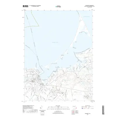
2018 Map of Siasconset
USGS Topo · Published 2018About this map
Nantucket serves as the focal point of this coastal survey, where the town's dense residential grid meets the expansive shoreline of the Atlantic Ocean. The landscape is defined by its maritime infrastructure and a high concentration of historical interment sites, including the Old North Cem, New North Cem, and the Friends Burial Ground. Beyond the settled area, the geography transitions into a series of interior wetlands and ponds such as Gibbs Pond and the Wigwam Ponds, illustrating the complex hydrology of the island. Notable landmarks like the Nantucket Memorial Airport and Altar Rock provide terrestrial reference points, while the Nantucket - Hyannis Ferry and Oak Bluffs - Nantucket Ferry routes trace the vital sea links that connect this community to the mainland.
Find a feature on this map
123 named features on this map. Tap any name to fly to it.
Don’t see what you’re looking for? This feature index may not catch every label — zoom into the map to look around manually.
Map Details
Editions of this 2018 Siasconset Map
This is the sole edition of this map. No revisions or reprints were ever made.
Other maps of this area

1889 · Nantucket
USGS Topo · 1:62,500

1893 · Nantucket
USGS Topo · 1:62,500

1901 · Nantucket
USGS Topo · 1:62,500

1942 · Nantucket
USGS Topo · 1:125,000

1945 · Nantucket
USGS Topo · 1:31,680

1945 · Siasconset
USGS Topo · 1:31,680

1945 · Great Point
USGS Topo · 1:31,680

1947 · Providence
USGS Topo · 1:250,000

1948 · Providence
USGS Topo · 1:250,000

1951 · Great Point
USGS Topo · 1:31,680