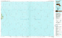
1994 Map of Siasconset
USGS Topo · Published 1994About this map
The eastern reaches of Nantucket Island meet the Atlantic Ocean in this coastal study based on data from 1972 and revised in the early 1990s. The landscape is defined by the high coastal bluffs of Sankaty Head and Tom Nevers Head, anchored by the Sankaty Head Light. While much of the sheet captures the vast offshore waters of the continental shelf, the landward portion reveals a settled shoreline where small communities like Wauwinet, Quidnet, and the village of Siasconset are connected by roads skirting the island's interior. Notable local features including a Cranberry Bog and the brackish Sesachacha Pond illustrate the unique ecological character of the area. A series of Radio Towers and a Coast Guard Sta near Low Beach highlight the maritime and navigational importance of this easternmost edge of Massachusetts.
Find a feature on this map
19 named features on this map. Tap any name to fly to it.
Don’t see what you’re looking for? This feature index may not catch every label — zoom into the map to look around manually.
Map Details
Editions of this 1994 Siasconset Map
This is the sole edition of this map. No revisions or reprints were ever made.
Other maps of this area

1887 · Yarmouth
USGS Topo · 1:62,500

1888 · Chatham
USGS Topo · 1:62,500

1889 · Yarmouth
USGS Topo · 1:62,500

1889 · Nantucket
USGS Topo · 1:62,500

1893 · Nantucket
USGS Topo · 1:62,500

1893 · Chatham
USGS Topo · 1:62,500

1893 · Yarmouth
USGS Topo · 1:62,500

1901 · Nantucket
USGS Topo · 1:62,500

1917 · Chatham
USGS Topo · 1:62,500

1942 · Cape Cod Bay
USGS Topo · 1:125,000