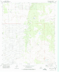
1972 Map of Sibley Hole
USGS Topo · Published 1976About this map
The high desert landscape of Luna County is defined by isolated ranching infrastructure and natural depressions that collect seasonal moisture. In the early 1970s, this area centered on Sibley Hole, a natural catchment that gives the quadrangle its name, and the prominent topographical feature known as the Rim. The land use is clearly agricultural and livestock-focused, evidenced by the presence of the White House Ranch and vital water sources like Brushy Tank and Blanco Tank. Named landmarks such as the High Lonesome Windmill and Board Ranch Windmill underscore the necessity of wind-driven water extraction in this arid terrain, marking specific points of human activity within an otherwise open range.
Find a feature on this map
8 named features on this map. Tap any name to fly to it.
Don’t see what you’re looking for? This feature index may not catch every label — zoom into the map to look around manually.
Map Details
Editions of this 1972 Sibley Hole Map
This is the sole edition of this map. No revisions or reprints were ever made.
Other maps of this area

1899 · Deming
USGS Topo · 1:125,000

1915 · Deming
USGS Topo · 1:125,000

1917 · Camel Mountain
USGS Topo · 1:62,500

1917 · Columbus
USGS Topo · 1:62,500

1918 · Columbus
USGS Topo · 1:62,500

1920 · Columbus
USGS Topo · 1:62,500

1953 · El Paso
USGS Topo · 1:250,000

1955 · Las Cruces
USGS Topo · 1:250,000

1958 · Las Cruces
USGS Topo · 1:250,000

1959 · El Paso
USGS Topo · 1:250,000