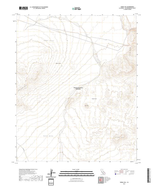
2021 Map of Signal Hill
USGS Topo · Published 2021About this map
Mojave National Preserve covers the central portion of this survey, where the high desert terrain transitions between several distinct valley systems. The arid landscape is defined by the broad Lanfair Valley to the north and Fenner Valley to the south, separated by the high ground of Billie Mtn and the expanse of Tungsten Flat. To the east, the Piute Range rises sharply, carrying the Piute Canyon Trail through its breaks. The southwestern corner is anchored by the Vontrigger Hills, while the eponymous Signal Hill stands as a prominent topographical landmark in the southeast. This 2021 update preserves the modern corridor of Lanfair Road, reflecting the sparse network of remote desert routes that continue to serve this corner of San Bernardino County.
Find a feature on this map
18 named features on this map. Tap any name to fly to it.
Don’t see what you’re looking for? This feature index may not catch every label — zoom into the map to look around manually.
Map Details
Editions of this 2021 Signal Hill Map
This is the sole edition of this map. No revisions or reprints were ever made.
Other maps of this area

1886 · Camp Mohave
USGS Topo · 1:250,000

1892 · Camp Mohave
USGS Topo · 1:250,000

1910 · Ivanpah
USGS Topo · 1:250,000

1912 · Ivanpah
USGS Topo · 1:250,000

1926 · Mohave City
USGS Topo · 1:96,000

1942 · Camp Mohave
USGS Topo · 1:250,000

1942 · Ivanpah
USGS Topo · 1:250,000

1942 · Amboy
USGS Topo · 1:250,000

1943 · Amboy
USGS Topo · 1:250,000

1943 · Fenner
USGS Topo · 1:62,500