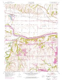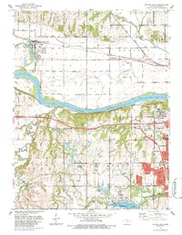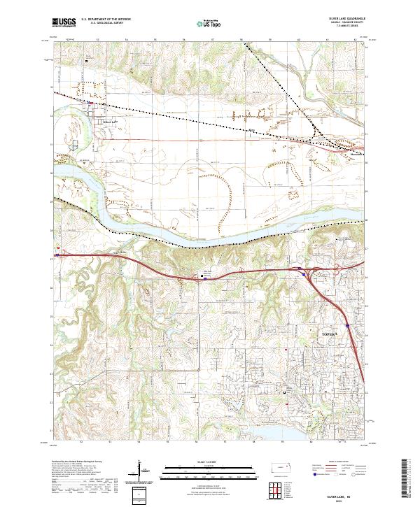
2022 Map of Silver Lake
USGS Topo · Published 2022About this map
The Kansas River flows through the center of this landscape, separating the agricultural plains to the north from the expanding residential and industrial outskirts of Topeka to the southeast. The town of Silver Lake sits north of the river, anchored by its namesake water body and the nearby Silver Lake Cem. Historically significant for its position along rail and river routes, this area shows a transition from smaller rural nodes like Kiro and Menoken to more densely developed urban fringes. To the south, the terrain rises toward Hickory Knob near the confluence of Mission Creek. Numerous burial grounds, including West Lawn Memorial Gardens and the Security Benefit Association Cem, are located on the bluffs overlooking the river valley, while tributaries like Soldier Creek and Shunganunga Cr drain the surrounding Shawnee County hillsides into the main channel.
Find a feature on this map
126 named features on this map. Tap any name to fly to it.
Don’t see what you’re looking for? This feature index may not catch every label — zoom into the map to look around manually.
Map Details
Editions of this 2022 Silver Lake Map
This is the sole edition of this map. No revisions or reprints were ever made.
Historical Maps of Topeka Through Time
3 maps found