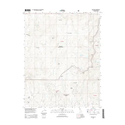
2015 Map of Sing Peak
USGS Topo · Published 2015About this map
Yosemite National Park and the Sierra National Forest meet at a high-elevation boundary defined by the crests of the Sierra Nevada. This landscape is characterized by the headwaters of the S Fork Merced River and Chiquito Cr, where glacial movement has left behind broad meadows like Moraine Meadows and Givens Meadow. Significant alpine passes such as Merced Pass, Fernandez Pass, and Chiquito Pass provide historical transit corridors through the granite peaks. The map reveals a dense network of water bodies, including the Hoover Lakes, Chain Lakes, and Spotted Lakes, which feed the various forks and creeks. This area, dominated by landmarks like Sing Peak and Madera Peak, remains largely primitive, with Beasore Rd being the primary automotive access point in the southern portion near Portuguese Cr.
Find a feature on this map
47 named features on this map. Tap any name to fly to it.
Don’t see what you’re looking for? This feature index may not catch every label — zoom into the map to look around manually.
Map Details
Editions of this 2015 Sing Peak Map
This is the sole edition of this map. No revisions or reprints were ever made.
Other maps of this area

1897 · Yosemite
USGS Topo · 1:125,000

1900 · Yosemite
USGS Topo · 1:125,000

1901 · Mt. Lyell
USGS Topo · 1:125,000

1903 · Yosemite
USGS Topo · 1:125,000

1904 · Kaiser
USGS Topo · 1:125,000

1909 · Yosemite
USGS Topo · 1:125,000

1912 · Mariposa
USGS Topo · 1:125,000

1947 · Mariposa
USGS Topo · 1:250,000

1948 · Mariposa
USGS Topo · 1:250,000

1953 · Merced Peak
USGS Topo · 1:62,500