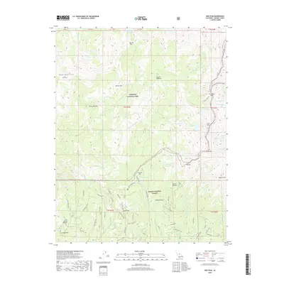
2018 Map of Sing Peak
USGS Topo · Published 2018About this map
Yosemite National Park and the Sierra National Forest meet at a high-elevation boundary defined by prominent summits and granite passes. The S Fork Merced River carves through the central terrain, fed by a network of alpine waters including Chain Lakes, Spotted Lakes, and Givens Lake. Historical land use is evident at Quartz Mountain, where a Prospect Mine and several survey spurs like Quartz Mtn A Spur indicate early mineral exploration. Notable peaks such as Sing Peak, Gale Peak, and Madera Peak anchor the skyline, while the California Riding and Hiking trail provides a dedicated corridor for movement through the high country. Low-lying grazing or camp areas like Klette Meadow and Brophy Meadow offer a contrast to the high ridges of the Buena Vista Crest.
Find a feature on this map
75 named features on this map. Tap any name to fly to it.
Don’t see what you’re looking for? This feature index may not catch every label — zoom into the map to look around manually.
Map Details
Editions of this 2018 Sing Peak Map
This is the sole edition of this map. No revisions or reprints were ever made.
Other maps of this area

1897 · Yosemite
USGS Topo · 1:125,000

1900 · Yosemite
USGS Topo · 1:125,000

1901 · Mt. Lyell
USGS Topo · 1:125,000

1903 · Yosemite
USGS Topo · 1:125,000

1904 · Kaiser
USGS Topo · 1:125,000

1909 · Yosemite
USGS Topo · 1:125,000

1912 · Mariposa
USGS Topo · 1:125,000

1947 · Mariposa
USGS Topo · 1:250,000

1948 · Mariposa
USGS Topo · 1:250,000

1953 · Merced Peak
USGS Topo · 1:62,500