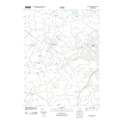
2010 Map of Sinking Spring
USGS Topo · Published 2010About this map
Wernersville and Sinking Spring anchor this Berks County landscape, which transitions from the developed corridors of the east to the high ridges of the west. The terrain is defined by the prominent Cushion Peak and Laurel Ridge, overlooking a network of creeks including Tulpehocken Creek and Cacoosing Creek. In the northern section, the waters of Blue Marsh Lake are a central feature, supported by the State Hill Boat Launch and the crossing at Rebers Bridge.
Find a feature on this map
117 named features on this map. Tap any name to fly to it.
Don’t see what you’re looking for? This feature index may not catch every label — zoom into the map to look around manually.
Map Details
Editions of this 2010 Sinking Spring Map
This is the sole edition of this map. No revisions or reprints were ever made.
Other maps of this area

1894 · Reading
USGS Topo · 1:62,500

1902 · Wernersville
USGS Topo · 1:62,500

1905 · Honey Brook
USGS Topo · 1:62,500

1906 · New Holland
USGS Topo · 1:62,500

1907 · Honeybrook
USGS Topo · 1:62,500

1908 · New Holland
USGS Topo · 1:62,500

1913 · Reading
USGS Topo · 1:62,500

1915 · Reading
USGS Topo · 1:62,500

1941 · Honeybrook
USGS Topo · 1:62,500

1941 · New Holland
USGS Topo · 1:62,500
Featured Places
- Sinking Spring, PA
- Wernersville, PA
- Reinholds, West Cocalico Township
- North Heidelberg Township, PA
- West Cocalico Township, PA