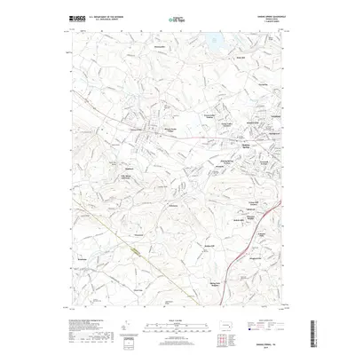
2019 Map of Sinking Spring
USGS Topo · Published 2019About this map
Sinking Spring and its surrounding residential developments anchor this Berks County landscape where suburban growth meets the rising terrain of Laurel Ridge. The map traces the varied topography from the northern reaches near Blue Marsh Lake down to the southern boundary where Adamstown Ridge marks the transition into Lancaster County. This area is characterized by a high concentration of institutional and community landmarks, including the Villa Maria Infirmary, the Phoebe Berks Village community, and several religious sites such as Saint Alban's Episcopal Church Columbarium. Genealogy researchers will find significant value in the numerous burial grounds documented, from the historic Hains Cem and Jesuit Cem to the Cocalico Mennonite Cem and Open Door Mennonite Cem. Local aviation is represented by Boyer Airport, while the legacy of early transportation is preserved through the Union Canal Trail following the path of Tulpehocken Creek.
Find a feature on this map
277 named features on this map. Tap any name to fly to it.
Don’t see what you’re looking for? This feature index may not catch every label — zoom into the map to look around manually.
Map Details
Editions of this 2019 Sinking Spring Map
This is the sole edition of this map. No revisions or reprints were ever made.
Other maps of this area

1894 · Reading
USGS Topo · 1:62,500

1902 · Wernersville
USGS Topo · 1:62,500

1905 · Honey Brook
USGS Topo · 1:62,500

1906 · New Holland
USGS Topo · 1:62,500

1907 · Honeybrook
USGS Topo · 1:62,500

1908 · New Holland
USGS Topo · 1:62,500

1913 · Reading
USGS Topo · 1:62,500

1915 · Reading
USGS Topo · 1:62,500

1941 · Honeybrook
USGS Topo · 1:62,500

1941 · New Holland
USGS Topo · 1:62,500
Featured Places
- Sinking Spring, PA
- Wernersville, PA
- Reinholds, West Cocalico Township
- North Heidelberg Township, PA
- West Cocalico Township, PA