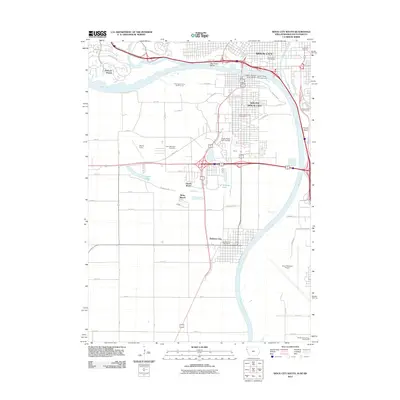
2012 Map of Sioux City South
USGS Topo · Published 2012About this map
Dakota City and South Sioux City anchor the western banks of the Missouri River in this 2012 survey of the tri-state border region. The landscape is defined by the sharp bends of the river, notably the Big Sioux Bend where the Big Sioux River joins from the north. High ground is visible at Floyds Bluff overlooking the Floyd River to the east, while the low-lying plains are dotted with numerous water features including Crystal Lake, Gateway Lake, and the recreational area at Millis Beach.
Find a feature on this map
63 named features on this map. Tap any name to fly to it.
Don’t see what you’re looking for? This feature index may not catch every label — zoom into the map to look around manually.
Map Details
Editions of this 2012 Sioux City South Map
This is the sole edition of this map. No revisions or reprints were ever made.
Other maps of this area

1898 · Elk Point
USGS Topo · 1:125,000

1901 · Elk Point
USGS Topo · 1:125,000

1907 · Elk Point
USGS Topo · 1:125,000

1955 · Sioux City
USGS Topo · 1:250,000

1958 · Sioux City
USGS Topo · 1:250,000

1959 · Sioux City
USGS Topo · 1:250,000

1963 · Sioux City South
USGS Topo · 1:24,000

1963 · Sioux City North
USGS Topo · 1:24,000

1963 · Jefferson
USGS Topo · 1:24,000

1964 · Sergeant Bluff
USGS Topo · 1:24,000