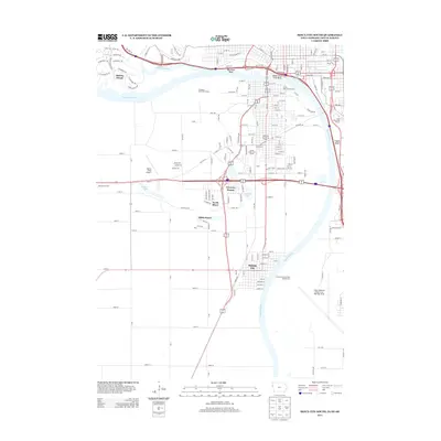
2013 Map of Sioux City South
USGS Topo · Published 2013About this map
Dakota City and the surrounding riverfront communities define this tri-state border region where Iowa, Nebraska, and South Dakota converge. The Missouri River carves a winding path through the landscape, shaped by prominent landmarks like Upper Sioux City Bend and the heights of Floyds Bluff. This 2013 survey illustrates a modern transport and recreation network, featuring the Sioux Gateway Airport and numerous leisure destinations including the Covington Links Golf Course and Cottonwood Cove Park Campground. Smaller residential pockets such as Freeway Homes, North Shore, and Millis Beach sit near the water's edge, highlighting the area's development around local lakes and river bends. The confluence of the Big Sioux River and the Missouri serves as a central geographic anchor, separating the planned streets of Dakota Dunes from the established neighborhoods of South Sioux City.
Find a feature on this map
176 named features on this map. Tap any name to fly to it.
Don’t see what you’re looking for? This feature index may not catch every label — zoom into the map to look around manually.
Map Details
Editions of this 2013 Sioux City South Map
This is the sole edition of this map. No revisions or reprints were ever made.
Other maps of this area

1898 · Elk Point
USGS Topo · 1:125,000

1901 · Elk Point
USGS Topo · 1:125,000

1907 · Elk Point
USGS Topo · 1:125,000

1955 · Sioux City
USGS Topo · 1:250,000

1958 · Sioux City
USGS Topo · 1:250,000

1959 · Sioux City
USGS Topo · 1:250,000

1963 · Sioux City South
USGS Topo · 1:24,000

1963 · Sioux City North
USGS Topo · 1:24,000

1963 · Jefferson
USGS Topo · 1:24,000

1964 · Sergeant Bluff
USGS Topo · 1:24,000