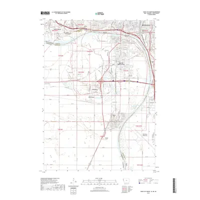
2018 Map of Sioux City South
USGS Topo · Published 2018About this map
The Missouri River carves a complex course through this tri-state junction where Iowa, Nebraska, and South Dakota converge. On the Iowa side, Sioux City occupies the northern bluffs, where landmark sites like the War Eagle Grave and Floyds Bluff overlook the river valley. To the west, the planned community of Dakota Dunes sits within a prominent bend of the river in South Dakota, while south across the Nebraska border, the grid of South Sioux City and the historic seat of Dakota City dominate the landscape.
Find a feature on this map
151 named features on this map. Tap any name to fly to it.
Don’t see what you’re looking for? This feature index may not catch every label — zoom into the map to look around manually.
Map Details
Editions of this 2018 Sioux City South Map
This is the sole edition of this map. No revisions or reprints were ever made.
Other maps of this area

1898 · Elk Point
USGS Topo · 1:125,000

1901 · Elk Point
USGS Topo · 1:125,000

1907 · Elk Point
USGS Topo · 1:125,000

1955 · Sioux City
USGS Topo · 1:250,000

1958 · Sioux City
USGS Topo · 1:250,000

1959 · Sioux City
USGS Topo · 1:250,000

1963 · Sioux City South
USGS Topo · 1:24,000

1963 · Sioux City North
USGS Topo · 1:24,000

1963 · Jefferson
USGS Topo · 1:24,000

1964 · Sergeant Bluff
USGS Topo · 1:24,000