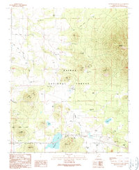
1989 Map of Sitgreaves Mountain
USGS Topo · Published 1990About this map
Kaibab National Forest dominates the high-elevation landscape of Coconino County, defined by the volcanic prominence of Sitgreaves Mountain and its surrounding cinder cones. The terrain is marked by a complex network of stock tanks—essential water sources in this arid environment—bearing names such as Schoolhouse Tank, White House Tank, and Frenchy Spring Tank. These labels suggest a history of ranching and remote settlement throughout the late 20th century.
Find a feature on this map
67 named features on this map. Tap any name to fly to it.
Don’t see what you’re looking for? This feature index may not catch every label — zoom into the map to look around manually.
Map Details
Editions of this 1989 Sitgreaves Mountain Map
This is the sole edition of this map. No revisions or reprints were ever made.
Other maps of this area

1886 · San Francisco Mtns
USGS Topo · 1:250,000

1886 · Chino
USGS Topo · 1:250,000

1891 · San Francisco Mtns
USGS Topo · 1:250,000

1891 · Chino
USGS Topo · 1:250,000

1894 · San Francisco Mtns
USGS Topo · 1:250,000

1899 · San Francisco Mtns
USGS Topo · 1:250,000

1908 · Flagstaff
USGS Topo · 1:125,000

1912 · Flagstaff
USGS Topo · 1:125,000

1922 · Williams
USGS Topo · 1:125,000

1947 · Flagstaff
USGS Topo · 1:250,000