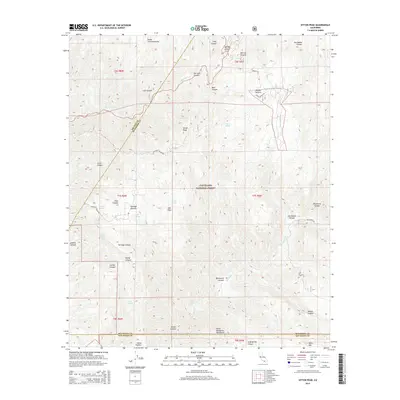
2015 Map of Sitton Peak
USGS Topo · Published 2015About this map
Sitton Peak dominates this section of the Cleveland National Forest, where the high ridgelines of the Santa Ana Mountains meet the Santa Margarita Mountains. The landscape is defined by its numerous potreros—grassy upland meadows—including Verdugo Potrero, Indian Potrero, and Round Potrero. These open spaces are connected by a network of historic fire roads and paths such as the Tenaja Truck Trl and Sitton Peak Truck Trl. A complex drainage system feeds into San Juan Cr and San Mateo Cr, supported by numerous perennial water sources like Pigeon Spring, Quail Spring, and Los Chinos Spring. The map documents a rugged wilderness area spanning the intersections of Orange, Riverside, and San Diego counties, preserving the names of remote canyons like Wildhorse Canyon and Talega Canyon.
Find a feature on this map
50 named features on this map. Tap any name to fly to it.
Don’t see what you’re looking for? This feature index may not catch every label — zoom into the map to look around manually.
Map Details
Editions of this 2015 Sitton Peak Map
This is the sole edition of this map. No revisions or reprints were ever made.
Other maps of this area

1901 · Southern California Sheet No. 1
USGS Topo · 1:250,000

1901 · Elsinore
USGS Topo · 1:125,000

1901 · San Luis Rey
USGS Topo · 1:125,000

1902 · Capistrano
USGS Topo · 1:125,000

1902 · Corona
USGS Topo · 1:125,000

1904 · Southern California Sheet No. 2
USGS Topo · 1:250,000

1904 · Southern California Sheet No. 1
USGS Topo · 1:250,000

1906 · Capistrano
USGS Topo · 1:125,000

1941 · Margarita Peak
USGS Topo · 1:62,500

1942 · Lake Elsinore
USGS Topo · 1:62,500
Featured Places
- Marine Corps Base Camp Pendleton, CA
- San Diego County, CA
- Orange County, CA
- Riverside County, CA
- United States