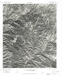
1974 Map of Sitton Peak
USGS Topo · Published 1977About this map
Sitton Peak dominates the center of this orthophotograph, serving as a primary high point for the surrounding Santa Ana Mountains. Unlike a traditional line-drawn map, this 1974 aerial survey provides a direct photographic view of the landscape, capturing the precise texture of the drainage systems and ridgelines. The network of deep ravines includes Morrell Canyon in the north and the extensive San Mateo Canyon reaching into the southern portion of the sheet. Produced in cooperation with the Orange County Board of Supervisors, the map highlights the area's undeveloped character during the mid-1970s. Tracing the steep walls of Bluemater Canyon and Tenaja Canyon reveals the complex erosion patterns and vegetation density that defined this portion of the Riverside and Orange County borderlands before modern expansion.
Find a feature on this map
5 named features on this map. Tap any name to fly to it.
Don’t see what you’re looking for? This feature index may not catch every label — zoom into the map to look around manually.
Map Details
Editions of this 1974 Sitton Peak Map
This is the sole edition of this map. No revisions or reprints were ever made.
Other maps of this area

1901 · Southern California Sheet No. 1
USGS Topo · 1:250,000

1901 · Elsinore
USGS Topo · 1:125,000

1901 · San Luis Rey
USGS Topo · 1:125,000

1902 · Capistrano
USGS Topo · 1:125,000

1902 · Corona
USGS Topo · 1:125,000

1904 · Southern California Sheet No. 2
USGS Topo · 1:250,000

1904 · Southern California Sheet No. 1
USGS Topo · 1:250,000

1906 · Capistrano
USGS Topo · 1:125,000

1941 · Margarita Peak
USGS Topo · 1:62,500

1942 · Lake Elsinore
USGS Topo · 1:62,500
Featured Places
- Marine Corps Base Camp Pendleton, CA
- San Diego County, CA
- Orange County, CA
- Riverside County, CA
- United States