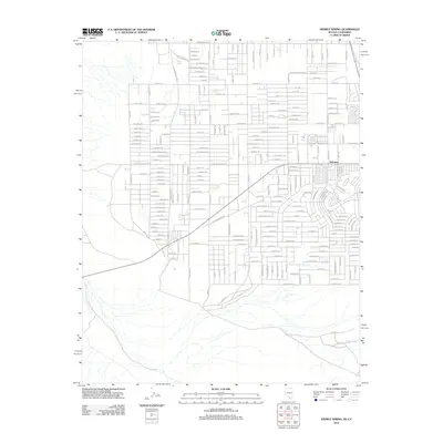
2012 Map of Sixmile Spring
USGS Topo · Published 2012About this map
Pahrump sits at the center of this 2012 survey, revealing the organized grid of residential development spreading across the Nye County landscape. The road network is particularly dense here, featuring names that suggest a mining or ranching heritage, such as Placer Ln, Assay Ln, and 2 T Ranch Ln. These residential corridors, including Halo Ave and Christian St, show the modern expansion of the community into the desert valley. To the northwest, the terrain shifts toward more open land near Sixmile Spring, a vital water source in this arid environment. The map also traces significant transit routes like the Old Shoshone Hwy and Charleston Park Ave, which link the central town to the surrounding foothills and mountain ranges.
Find a feature on this map
210 named features on this map. Tap any name to fly to it.
Don’t see what you’re looking for? This feature index may not catch every label — zoom into the map to look around manually.
Map Details
Editions of this 2012 Sixmile Spring Map
This is the sole edition of this map. No revisions or reprints were ever made.
Other maps of this area

1907 · Las Vegas
USGS Topo · 1:250,000

1908 · Furnace Creek
USGS Topo · 1:250,000

1908 · Las Vegas
USGS Topo · 1:250,000

1910 · Furnace Creek
USGS Topo · 1:250,000

1948 · Death Valley
USGS Topo · 1:250,000

1954 · Las Vegas
USGS Topo · 1:250,000

1954 · Death Valley
USGS Topo · 1:250,000

1956 · Death Valley
USGS Topo · 1:250,000

1957 · Las Vegas
USGS Topo · 1:250,000

1957 · Death Valley
USGS Topo · 1:250,000