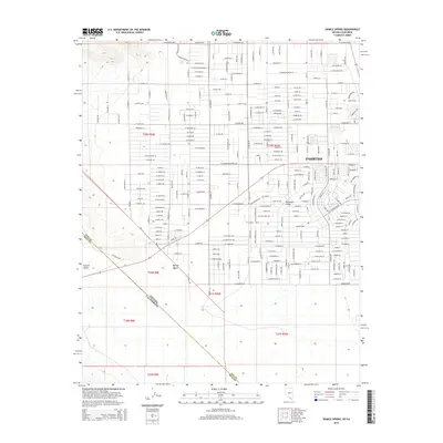
2014 Map of Sixmile Spring
USGS Topo · Published 2014About this map
Pahrump occupies the heart of this Nevada landscape, showing the dense grid of residential streets and arterial roads characteristic of its modern expansion. Situated within the broader Pahrump Valley, the settlement is defined by an extensive network of named thoroughfares including W Mesquite Ave and Ranch St, reflecting the area's transition from open land to a structured desert community. The western edge of the map gives way to the vast Mojave Desert, where the elevation begins to climb into the foothills of the Spring Mountains.
Find a feature on this map
118 named features on this map. Tap any name to fly to it.
Don’t see what you’re looking for? This feature index may not catch every label — zoom into the map to look around manually.
Map Details
Editions of this 2014 Sixmile Spring Map
This is the sole edition of this map. No revisions or reprints were ever made.
Other maps of this area

1907 · Las Vegas
USGS Topo · 1:250,000

1908 · Furnace Creek
USGS Topo · 1:250,000

1908 · Las Vegas
USGS Topo · 1:250,000

1910 · Furnace Creek
USGS Topo · 1:250,000

1948 · Death Valley
USGS Topo · 1:250,000

1954 · Las Vegas
USGS Topo · 1:250,000

1954 · Death Valley
USGS Topo · 1:250,000

1956 · Death Valley
USGS Topo · 1:250,000

1957 · Las Vegas
USGS Topo · 1:250,000

1957 · Death Valley
USGS Topo · 1:250,000