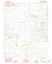
1984 Map of Sixmile Spring
USGS Topo · Published 1984About this map
Pahrump Valley dominates this desert landscape, showing the mid-1980s expansion of Pahrump at the Nevada-California border. The map documents a transition from open desert to a planned residential grid, evidenced by the emerging network of boulevards like Calvada Blvd and Coyotes Blvd, alongside a local Golf Course. Historically significant surveying markers are present, including the Von Schmidt Line (1873), which reflects the long-standing boundary efforts between Nye and Inyo Counties.
Find a feature on this map
28 named features on this map. Tap any name to fly to it.
Don’t see what you’re looking for? This feature index may not catch every label — zoom into the map to look around manually.
Map Details
Editions of this 1984 Sixmile Spring Map
This is the sole edition of this map. No revisions or reprints were ever made.
Other maps of this area

1907 · Las Vegas
USGS Topo · 1:250,000

1908 · Furnace Creek
USGS Topo · 1:250,000

1908 · Las Vegas
USGS Topo · 1:250,000

1910 · Furnace Creek
USGS Topo · 1:250,000

1948 · Death Valley
USGS Topo · 1:250,000

1954 · Las Vegas
USGS Topo · 1:250,000

1954 · Death Valley
USGS Topo · 1:250,000

1956 · Death Valley
USGS Topo · 1:250,000

1957 · Las Vegas
USGS Topo · 1:250,000

1957 · Death Valley
USGS Topo · 1:250,000