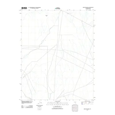
2012 Map of Skeleton Hills
USGS Topo · Published 2012About this map
The Skeleton Hills rise across this arid stretch of Nye County, where the desert floor is defined by a complex network of ephemeral drainage patterns. The most prominent hydrological feature is the Rock Valley Wash, which snakes across the landscape from the north and west. Human presence is marked primarily by a few straight-line road corridors that traverse the open basins, including Fairbanks Rd in the south and Imvite Rd to the east. These routes follow the natural contours of the valley floors, avoiding the more elevated terrain of the hills. This 2012 survey illustrates the stark, undeveloped nature of this corner of Nevada, where vast distances are linked only by these sparse unpaved roads and the natural conduits of seasonal washes.
Find a feature on this map
5 named features on this map. Tap any name to fly to it.
Don’t see what you’re looking for? This feature index may not catch every label — zoom into the map to look around manually.
Map Details
Editions of this 2012 Skeleton Hills Map
This is the sole edition of this map. No revisions or reprints were ever made.
Other maps of this area

1908 · Furnace Creek
USGS Topo · 1:250,000

1910 · Furnace Creek
USGS Topo · 1:250,000

1942 · Skull Mountain
USGS Topo · 1:125,000

1948 · Death Valley
USGS Topo · 1:250,000

1952 · Ash Meadows
USGS Topo · 1:62,500

1952 · Specter Range
USGS Topo · 1:62,500

1954 · Death Valley
USGS Topo · 1:250,000

1956 · Death Valley
USGS Topo · 1:250,000

1957 · Death Valley
USGS Topo · 1:250,000

1958 · Death Valley
USGS Topo · 1:250,000