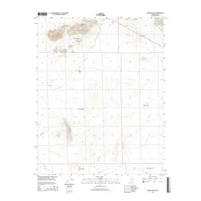
2015 Map of Skeleton Hills
USGS Topo · Published 2015About this map
Skeleton Hills rise from the northern reaches of the Mojave Desert in this portion of Nye County. The landscape is defined by the ephemeral drainage of Rock Valley Wash, which cuts across the arid basin between isolated ridges. This 2015 survey shows a remote area where the natural topography is segmented primarily by the lines of the Public Land Survey System, including t16s r50e and t15s r51e. While largely undeveloped, the terrain is traversed by several desert tracks, such as Cook Rd, Mecca Rd E, and Invite Rd, which provide the only modern markers of navigation through the alluvial fans and rocky outcrops of this high-desert environment.
Find a feature on this map
12 named features on this map. Tap any name to fly to it.
Don’t see what you’re looking for? This feature index may not catch every label — zoom into the map to look around manually.
Map Details
Editions of this 2015 Skeleton Hills Map
This is the sole edition of this map. No revisions or reprints were ever made.
Other maps of this area

1908 · Furnace Creek
USGS Topo · 1:250,000

1910 · Furnace Creek
USGS Topo · 1:250,000

1942 · Skull Mountain
USGS Topo · 1:125,000

1948 · Death Valley
USGS Topo · 1:250,000

1952 · Ash Meadows
USGS Topo · 1:62,500

1952 · Specter Range
USGS Topo · 1:62,500

1954 · Death Valley
USGS Topo · 1:250,000

1956 · Death Valley
USGS Topo · 1:250,000

1957 · Death Valley
USGS Topo · 1:250,000

1958 · Death Valley
USGS Topo · 1:250,000