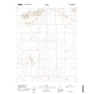
2018 Map of Skeleton Hills
USGS Topo · Published 2018About this map
Skeleton Hills rise from the arid floor of the Mojave Desert in this high-desert landscape within Nye County. The area is defined by the broad drainage of Rock Valley Wash, which cuts a wide path southeast through the center of the sheet. Sparse desert roads such as Cook Rd and Mecca Rd E provide the primary access through this open terrain, marking a shift from the rugged topography of the hills to the flatter alluvial plains. US Highway 95 clips the northern corner of the quadrangle, serving as the major regional artery connecting this isolated section of the Mojave to the wider Nevada desert network. The land is strictly organized by the Public Land Survey System, with township boundaries like t16s r50e overlaying the natural features.
Find a feature on this map
13 named features on this map. Tap any name to fly to it.
Don’t see what you’re looking for? This feature index may not catch every label — zoom into the map to look around manually.
Map Details
Editions of this 2018 Skeleton Hills Map
This is the sole edition of this map. No revisions or reprints were ever made.
Other maps of this area

1908 · Furnace Creek
USGS Topo · 1:250,000

1910 · Furnace Creek
USGS Topo · 1:250,000

1942 · Skull Mountain
USGS Topo · 1:125,000

1948 · Death Valley
USGS Topo · 1:250,000

1952 · Ash Meadows
USGS Topo · 1:62,500

1952 · Specter Range
USGS Topo · 1:62,500

1954 · Death Valley
USGS Topo · 1:250,000

1956 · Death Valley
USGS Topo · 1:250,000

1957 · Death Valley
USGS Topo · 1:250,000

1958 · Death Valley
USGS Topo · 1:250,000