
1972 Map of Skull Butte
USGS Topo · Published 1975About this map
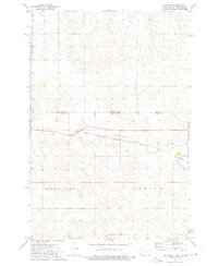
Skull Butte rises as a prominent landmark in this prairie landscape of the early 1970s, located entirely within the Standing Rock Indian Reservation. The area is defined by the drainage patterns of Dirt Lodge Creek and Cedar Boy Creek, where the terrain is marked by fine red dashed lines indicating fence and field boundaries visible during the 1972 aerial survey. The small settlement of Duncan sits in the southeastern portion of the map near a mapped Well, reflecting the localized agricultural and ranching infrastructure of this part of Corson County. The map also delineates large territorial divisions including Custer, Pioneer, and Sherman, alongside industrial traces like a Gravel Pit. This survey captures the rural character of the reservation before modern shifts in land use, showing a world of isolated wells and sprawling section lines.
Find a feature on this map
9 named features on this map. Tap any name to fly to it.
Don’t see what you’re looking for? This feature index may not catch every label — zoom into the map to look around manually.
Map Details
Editions of this 1972 Skull Butte Map
This is the sole edition of this map. No revisions or reprints were ever made.
Other maps of this area

1953 · McIntosh
USGS Topo · 1:250,000

1956 · Cottonwood Creek NE
USGS Topo · 1:24,000

1956 · Cottonwood Creek NW
USGS Topo · 1:24,000

1958 · McIntosh
USGS Topo · 1:250,000

1972 · Morristown
USGS Topo · 1:24,000

1972 · Morristown SE
USGS Topo · 1:24,000

1972 · Thunder Hawk SE
USGS Topo · 1:24,000
1972 · Keldron
USGS Topo · 1:24,000

1972 · Watauga
USGS Topo · 1:24,000

1972 · Black Horse Butte NE
USGS Topo · 1:24,000