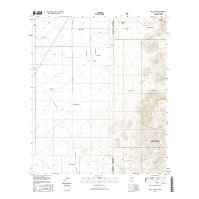
2017 Map of Skull Canyon
USGS Topo · Published 2017About this map
The Peloncillo Mountains dominate the eastern landscape of this quadrangle, marking a dramatic transition from the San Simon Valley to the high ridges of the Coronado National Forest. This borderlands region, where the Arizona New Mexico state line bisects the terrain, is defined by an intricate network of drainage systems and canyons. The geography is characterized by seasonal water sources and ranching infrastructure, evidenced by the presence of Kimble Tank, Allen Tank, and Natural Tanks tucked into the foothills.
Find a feature on this map
43 named features on this map. Tap any name to fly to it.
Don’t see what you’re looking for? This feature index may not catch every label — zoom into the map to look around manually.
Map Details
Editions of this 2017 Skull Canyon Map
This is the sole edition of this map. No revisions or reprints were ever made.
Other maps of this area

1917 · Chiricahua
USGS Topo · 1:125,000

1918 · Animas Peak
USGS Topo · 1:62,500

1918 · Pratt
USGS Topo · 1:62,500

1919 · Pratt
USGS Topo · 1:62,500

1919 · Chiricahua
USGS Topo · 1:125,000

1920 · Animas Peak
USGS Topo · 1:62,500

1926 · Rodeo
USGS Topo · 1:62,500

1940 · Apache
USGS Topo · 1:62,500

1955 · Douglas
USGS Topo · 1:250,000

1958 · Apache
USGS Topo · 1:62,500