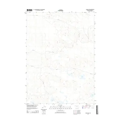
2014 Map of Skunk Lake
USGS Topo · Published 2014About this map
Skunk Lake and several smaller basins define the hydrography of this Sheridan County landscape, where the sandy, undulating terrain suggests the edges of the Nebraska Sandhills. A sparse network of primitive routes, including 295th Trl and 326th Trl, crisscross the area, following the natural contours of the land rather than a rigid grid. These trails provide access to the water bodies that dot the southern half of the map, such as Goose Lake and Dillings Lake. The absence of dense settlement or built infrastructure highlights the rural character of this region during the early twenty-first century, emphasizing its use for ranching or conservation. On the southern edge, Long Lake further illustrates the cluster of seasonal and permanent wetlands that characterize this unique ecosystem.
Find a feature on this map
8 named features on this map. Tap any name to fly to it.
Don’t see what you’re looking for? This feature index may not catch every label — zoom into the map to look around manually.
Map Details
Editions of this 2014 Skunk Lake Map
This is the sole edition of this map. No revisions or reprints were ever made.
Other maps of this area

1948 · Antioch
USGS Topo · 1:62,500

1948 · Lakeside
USGS Topo · 1:62,500

1948 · Twin Lakes
USGS Topo · 1:62,500

1949 · Antioch
USGS Topo · 1:62,500

1950 · Twin Lakes
USGS Topo · 1:62,500

1950 · Lakeside
USGS Topo · 1:62,500

1950 · Skunk Lake
USGS Topo · 1:62,500

1955 · Alliance
USGS Topo · 1:250,000

1957 · Alliance
USGS Topo · 1:250,000

1958 · Alliance
USGS Topo · 1:250,000