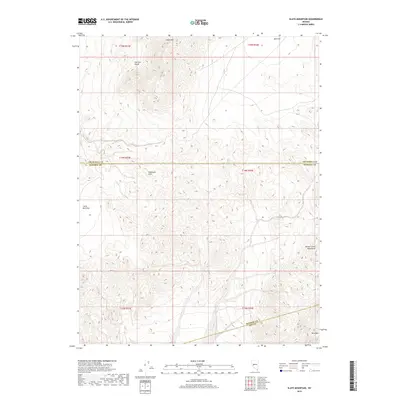
2018 Map of Slate Mountain
USGS Topo · Published 2018About this map
Slate Mtn and the Fairview Range anchor this high-desert landscape at the intersection of Churchill, Mineral, and Nye counties. The terrain is defined by complex ridgelines and secluded basins, most notably the expansive Bell Flat to the northeast and Little Bell Flat to the west. Central to the map are the Sinkavata Hills, which sit between these larger mountain systems, providing a window into the geological isolation of the Great Basin during the early 21st century. To the southeast, the slopes of the Monte Cristo Mountains rise toward Mt Anna, marking a dramatic topographic boundary. This map captures a region primarily defined by its physical geography and survey townships, showing no permanent settlements, but instead focusing on the distinct landforms that have guided travel and mineral exploration through this part of Nevada for generations.
Find a feature on this map
15 named features on this map. Tap any name to fly to it.
Don’t see what you’re looking for? This feature index may not catch every label — zoom into the map to look around manually.
Map Details
Editions of this 2018 Slate Mountain Map
This is the sole edition of this map. No revisions or reprints were ever made.
Other maps of this area

1908 · Carson Sink
USGS Topo · 1:250,000

1909 · Hawthorne
USGS Topo · 1:250,000

1910 · Carson Sink
USGS Topo · 1:250,000

1911 · Hawthorne
USGS Topo · 1:250,000

1915 · Hawthorne
USGS Topo · 1:250,000

1948 · Walker Lake
USGS Topo · 1:250,000

1957 · Walker Lake
USGS Topo · 1:250,000

1957 · Reno
USGS Topo · 1:250,000

1959 · Reno
USGS Topo · 1:250,000

1960 · Reno
USGS Topo · 1:250,000