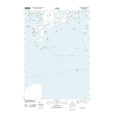
2011 Map of Small Point
USGS Topo · Published 2011About this map
Fort Baldwin stands as a prominent sentinel overlooking the entrance to the Kennebec region, anchoring a landscape defined by jagged Maine coastlines and maritime history. This 2011 survey details the intricate shoreline where Casco Bay meets the Atlantic Ocean, revealing a complex network of peninsulas and islands. The geography is marked by historic aids to navigation, including the Fuller Rock Lighthouse and Pond Island Light, which have long guided vessels through the treacherous Buttonmold Ledges and past Cape Small.
Find a feature on this map
83 named features on this map. Tap any name to fly to it.
Don’t see what you’re looking for? This feature index may not catch every label — zoom into the map to look around manually.
Map Details
Editions of this 2011 Small Point Map
This is the sole edition of this map. No revisions or reprints were ever made.
Other maps of this area

1893 · Small Point
USGS Topo · 1:62,500

1893 · Boothbay
USGS Topo · 1:62,500

1894 · Bath
USGS Topo · 1:62,500

1919 · Small Point
USGS Topo · 1:62,500

1920 · Bath
USGS Topo · 1:62,500

1941 · Boothbay
USGS Topo · 1:62,500

1943 · Boothbay
USGS Topo · 1:62,500

1944 · Boothbay
USGS Topo · 1:62,500

1944 · Small Point
USGS Topo · 1:62,500

1945 · Bath
USGS Topo · 1:62,500