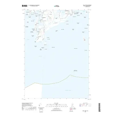
2018 Map of Small Point
USGS Topo · Published 2018About this map
Fort Baldwin stands atop the heights overlooking Atkins Bay and Popham Beach, anchoring a coastal landscape defined by peninsulas and tide-washed rivers. This modern survey detail the intricate geography of the Phippsburg area, from the rocky elevations of Morse Mtn and Small Point Hill to the wetlands bordering the Morse River and Sprague River. The map provides a precise look at the road networks serving local communities, including West Point and the neighborhood surrounding Small Point Harbor. Genealogy researchers can locate the Wallace Cem near the southern tip of the peninsula at Cape Small, while maritime historians can trace the numerous ledges and islands, such as Hermit Island and Pond Island, that have shaped navigation in Casco Bay and the open Atlantic Ocean for generations.
Find a feature on this map
92 named features on this map. Tap any name to fly to it.
Don’t see what you’re looking for? This feature index may not catch every label — zoom into the map to look around manually.
Map Details
Editions of this 2018 Small Point Map
This is the sole edition of this map. No revisions or reprints were ever made.
Other maps of this area

1893 · Small Point
USGS Topo · 1:62,500

1893 · Boothbay
USGS Topo · 1:62,500

1894 · Bath
USGS Topo · 1:62,500

1919 · Small Point
USGS Topo · 1:62,500

1920 · Bath
USGS Topo · 1:62,500

1941 · Boothbay
USGS Topo · 1:62,500

1943 · Boothbay
USGS Topo · 1:62,500

1944 · Boothbay
USGS Topo · 1:62,500

1944 · Small Point
USGS Topo · 1:62,500

1945 · Bath
USGS Topo · 1:62,500