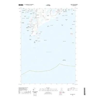
2021 Map of Small Point
USGS Topo · Published 2021About this map
Fort Baldwin stands atop the shoreline near Sabino Hill, anchoring a landscape where the Sprague River and Atkins Bay meet the Atlantic. This coastal area of Phippsburg is defined by its series of rocky points and sheltered coves, including Carrying Place Cove and Small Point Harbor. The map documents established settlements like West Point and Popham Beach, alongside topographic landmarks such as Morse Mtn and Morse Hill. For those researching local families, the Wallace Cem is clearly marked near the road to Head Beach RD. The offshore environment is equally detailed, featuring significant navigational markers like Seguin Island and Pond Island, which have long guided maritime traffic into these Maine waters. From the marshes of the Sprague River to the stretches of Hunnewell Beach, the map captures the intersection of coastal topography and long-standing human habitation.
Find a feature on this map
91 named features on this map. Tap any name to fly to it.
Don’t see what you’re looking for? This feature index may not catch every label — zoom into the map to look around manually.
Map Details
Editions of this 2021 Small Point Map
This is the sole edition of this map. No revisions or reprints were ever made.
Other maps of this area

1893 · Small Point
USGS Topo · 1:62,500

1893 · Boothbay
USGS Topo · 1:62,500

1894 · Bath
USGS Topo · 1:62,500

1919 · Small Point
USGS Topo · 1:62,500

1920 · Bath
USGS Topo · 1:62,500

1941 · Boothbay
USGS Topo · 1:62,500

1943 · Boothbay
USGS Topo · 1:62,500

1944 · Boothbay
USGS Topo · 1:62,500

1944 · Small Point
USGS Topo · 1:62,500

1945 · Bath
USGS Topo · 1:62,500