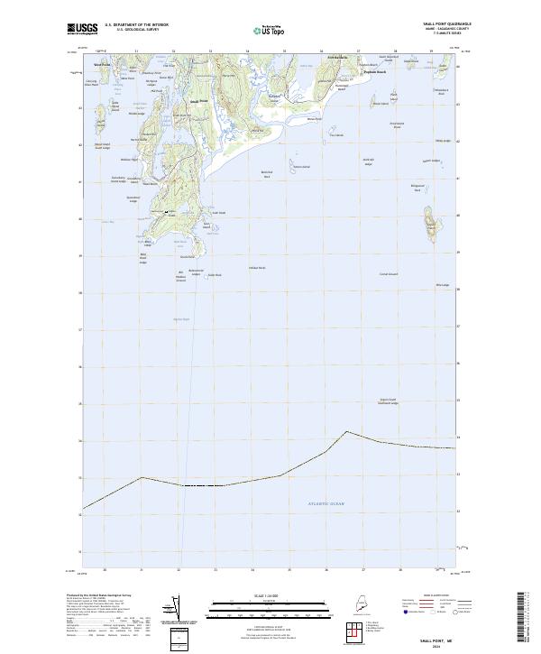
2024 Map of Small Point
USGS Topo · Published 2024About this map
Fort Baldwin stands as a prominent landmark on the eastern edge of this coastal peninsula, overlooking Atkins Bay and the approach to the Kennebec River. The 2024 landscape is defined by its intricate shoreline, where the granite outcrops of Morse Mtn and Sabino Hill meet the Atlantic. The map reveals a mix of protected natural spaces and seasonal settlements, from the sands of Hunnewell Beach to the secluded Pond Island National Wildlife Refuge. Traces of local lineage are anchored by the Wallace Cem near the head of the peninsula, while fishing communities at West Point and Small Point highlight the enduring maritime character of the region. Numerous named ledges and islands, such as Seguin Island and the Fox Islands, underscore the navigation hazards and maritime history inherent to this stretch of Sagadahoc County.
Find a feature on this map
93 named features on this map. Tap any name to fly to it.
Don’t see what you’re looking for? This feature index may not catch every label — zoom into the map to look around manually.
Map Details
Editions of this 2024 Small Point Map
This is the sole edition of this map. No revisions or reprints were ever made.
Other maps of this area

1893 · Small Point
USGS Topo · 1:62,500

1893 · Boothbay
USGS Topo · 1:62,500

1894 · Bath
USGS Topo · 1:62,500

1919 · Small Point
USGS Topo · 1:62,500

1920 · Bath
USGS Topo · 1:62,500

1941 · Boothbay
USGS Topo · 1:62,500

1943 · Boothbay
USGS Topo · 1:62,500

1944 · Boothbay
USGS Topo · 1:62,500

1944 · Small Point
USGS Topo · 1:62,500

1945 · Bath
USGS Topo · 1:62,500