2023 Map of Smithfield
USGS Topo · Published 2023About this map
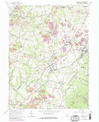
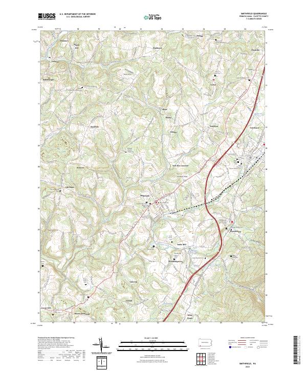
Smithfield serves as a central hub in Fayette County, where the convergence of Morgantown Rd and local rail lines historically shaped the regional settlement pattern. This landscape is densely marked by genealogical sites, including the Mount Moriah Baptist Cem and the Springer - Bowell - Jones Cem, reflecting generations of family homesteads. The terrain transitions from the rolling hills around Dugan Hill to the water-carved valleys of Georges Creek and Mountain Creek. Smaller communities like Haydentown, York Run, and Collier are scattered throughout, often anchored by historic denominational landmarks such as the Tent Presbyterian Cem and the Grove Church Cem. The presence of the Skala Airport and several small reservoirs like Seghis Lakes indicates the evolving land use in this part of southwestern Pennsylvania, where agriculture and transit corridors remain vital to the local geography.
Find a feature on this map
70 named features on this map. Tap any name to fly to it.
Don’t see what you’re looking for? This feature index may not catch every label — zoom into the map to look around manually.
Map Details
Editions of this 2023 Smithfield Map
This is the sole edition of this map. No revisions or reprints were ever made.