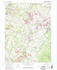
1964 Map of Smithfield
USGS Topo · Published 1979About this map
Smithfield and Fairchance anchor this landscape during a period of significant industrial transition in Fayette County. The map documents an intensive mineral extraction economy, characterized by numerous Strip Mine operations and industrial landmarks like the Coke Ovens near Leckrone. Transport infrastructure is dominated by the Baltimore and Ohio railroad, which links the scattered settlements of Shoaf, Outcrop, and Highhouse.
Find a feature on this map
73 named features on this map. Tap any name to fly to it.
Don’t see what you’re looking for? This feature index may not catch every label — zoom into the map to look around manually.
Map Details
Editions of this 1964 Smithfield Map
Other maps of this area

1900 · Uniontown
USGS Topo · 1:62,500

1900 · Masontown
USGS Topo · 1:62,500

1902 · Morgantown
USGS Topo · 1:62,500

1903 · Masontown
USGS Topo · 1:62,500

1904 · Bruceton
USGS Topo · 1:62,500

1925 · Morgantown
USGS Topo · 1:62,500

1926 · Bruceton
USGS Topo · 1:62,500

1931 · Uniontown
USGS Topo · 1:62,500

1931 · Masontown
USGS Topo · 1:62,500

1931 · Bruceton Mills
USGS Topo · 1:62,500