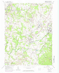
1964 Map of Smithfield
USGS Topo · Published 1973About this map
Extensive coal mining and industrial infrastructure define this Fayette County landscape during the mid-1960s, with updates reflecting the early 1970s. The region is marked by numerous strip mines and industrial artifacts like the coke ovens near Leckrone. High-density rail networks, including the Baltimore and Ohio Railroad and various branches, connect centers like Smithfield and Fairchance. This era shows a transition where traditional landmarks like the Ruble Mill and Mt Moriah Ch coexist with modern additions like a drive-in theater near York Run. The settlement pattern follows the drainages of Georges Creek and York Run, where small mining communities and junctions like York Run Junction reveal the historical economic dependence on the underlying geology of the Appalachian Plateau.
Find a feature on this map
71 named features on this map. Tap any name to fly to it.
Don’t see what you’re looking for? This feature index may not catch every label — zoom into the map to look around manually.
Map Details
Editions of this 1964 Smithfield Map
Other maps of this area

1900 · Uniontown
USGS Topo · 1:62,500

1900 · Masontown
USGS Topo · 1:62,500

1902 · Morgantown
USGS Topo · 1:62,500

1903 · Masontown
USGS Topo · 1:62,500

1904 · Bruceton
USGS Topo · 1:62,500

1925 · Morgantown
USGS Topo · 1:62,500

1926 · Bruceton
USGS Topo · 1:62,500

1931 · Uniontown
USGS Topo · 1:62,500

1931 · Masontown
USGS Topo · 1:62,500

1931 · Bruceton Mills
USGS Topo · 1:62,500