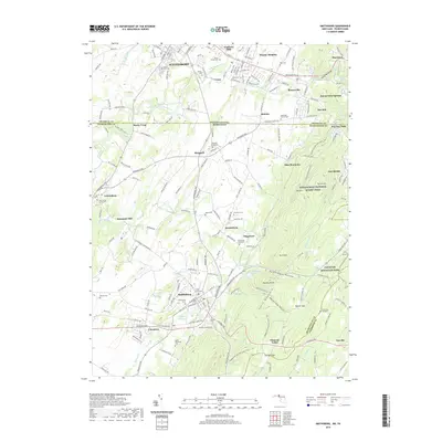
2019 Map of Smithsburg
USGS Topo · Published 2019About this map
Waynesboro and the surrounding borderlands of Pennsylvania and Maryland are depicted here in a landscape defined by the transition from industrial valley floors to the high ridges of South Mountain. The map centers on the small borough of Smithsburg, where the rail and road networks converge near the Smithsburg Reservoir and Edgemont Reservoir. This area has long served as a vital corridor, evident in the numerous small settlements like Leitersburg, Ringgold, and Edgemont that dot the lower elevations.
Find a feature on this map
209 named features on this map. Tap any name to fly to it.
Don’t see what you’re looking for? This feature index may not catch every label — zoom into the map to look around manually.
Map Details
Editions of this 2019 Smithsburg Map
This is the sole edition of this map. No revisions or reprints were ever made.
Other maps of this area

1902 · Chambersburg
USGS Topo · 1:62,500

1909 · Fairfield
USGS Topo · 1:62,500

1909 · Hagerstown
USGS Topo · 1:48,000

1911 · Emmitsburg
USGS Topo · 1:62,500

1912 · Hagerstown
USGS Topo · 1:62,500

1942 · Hagerstown
USGS Topo · 1:125,000

1942 · Gettysburg
USGS Topo · 1:125,000

1943 · Emmitsburg
USGS Topo · 1:62,500

1943 · Hagerstown
USGS Topo · 1:125,000

1943 · Chambersburg
USGS Topo · 1:62,500
Featured Places
- Waynesboro, PA
- Smithsburg, MD
- Wayne Heights, Washington Township
- Cavetown, MD
- Pen Mar, Washington Township